I think your video makes the mistake of taking relative measurements and calling them absolute.
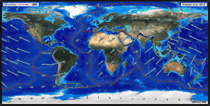
"Global map of current absolute plate motion as calculated using GPS technology and the Jules Verne Voyager: Earth software. The direction of arrows indicated the direction of plate movement. The length of the arrow indicates the speed of movement (note relative arrow length of the key in the upper left corner)."
As you said before, satellite readings show an average movement eastward in Japan.
However, this movement is all attributable to seismic events; averaging out the movement over time to present a slow, gradual scenario is to misrepresent the data.
"This animation shows that GPS can record the movement of the leading edge of the overlying continental plate in a subduction zone. The plates are locked and the overlying plate is forced back. When friction is overcome and strain is released, the GPS receiver will snap back toward its original position. This animation is exaggerated to depict the relative motion of plates and GPS as seen in the 2010 Magnitude 8.8 earthquake in Chile where the land in places rebounded 10 meters":
| . | |